Sailing from Falmouth to the Isles of Scilly: A Practical Passage Plan
A direct passage from Falmouth to the Isles of Scilly takes about 18 to 24 hours for a typical cruising yacht, covering roughly 65 nautical miles. This plan sets out the main tidal gates, waypoints and shelter options so you can time the trip to suit your crew and the weather window.
How long does it take to sail from Falmouth to the Isles of Scilly?
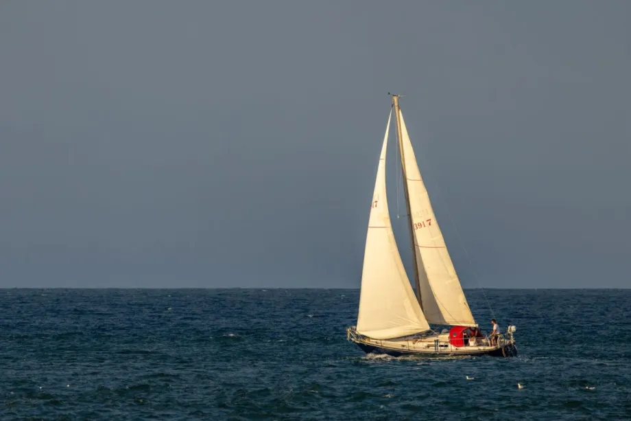
A cruising yacht typically takes between 12 and 16 hours to cover the 60 nautical miles from Falmouth to St Mary's. A boat making 5 knots over the ground will complete the passage in roughly 12 hours of actual sailing, though the total time from harbour to harbour is often closer to 15 hours once you add the run out of the Carrick Roads and the final approach into the islands.
Several factors stretch or shorten the trip. A fair tide around Land's End can add 2 knots to your speed over ground, while punching an adverse stream may knock you back to 3 knots or less. Wind direction matters just as much. A brisk northerly gives a fast broad reach, but a light southwesterly on the nose turns the same distance into a long motor. The boat itself also plays a part. A modern 40-footer will reel off the miles noticeably quicker than a heavy long-keel 30-footer.
An overnight departure from Falmouth often works well. Leaving in the late evening lets you carry the westgoing tidal stream past Land's End and arrive at the Isles of Scilly in daylight the next morning. It also gives you a wider weather window. If the forecast changes, you still have the option to divert into Newlyn or St Ives rather than pressing on into the dark.
What is the best time to leave Falmouth?
You plan your departure around the tidal gate at Land’s End, where the stream runs hard and dictates your arrival time some 40 miles west. You want the west-going stream to carry you past the headland, so you leave Falmouth about four to five hours before the west-going stream begins at Land’s End.
As a worked example, if the west-going stream starts at 1400 BST off Land’s End, you slip your mooring in Falmouth by 0900 to 1000. A cruising yacht making five knots will cover the ground in roughly eight hours, arriving just as the tide turns favourable. Leaving earlier means punching the last of the east-going stream off the Lizard, which slows you down and builds a steeper sea in any wind-over-tide situation.
The east-going stream is your fallback for a daylight departure the evening before. You leave Falmouth just as the east-going stream begins, carry it to a sheltered anchorage such as Mousehole or Newlyn, and wait out the foul tide before rounding Land’s End on the next west-going stream.
Key waypoints for the route
A clear set of waypoints helps you track progress and keep clear of hazards. The route runs roughly west-southwest for about 65 nautical miles, with the Lizard and Land’s End as the two main headlands to round.
- Falmouth entrance (50°09.0'N 005°02.0'W) to the Manacles buoy. Leave the notorious Manacles reef well to port and head for the Lizard, about 16 miles.
- Lizard Point to the Runnel Stone buoy south of Land’s End. Give the Lizard a comfortable offing of at least a mile and set course for the Runnel Stone, roughly 25 miles.
- Runnel Stone to the Traffic Separation Scheme boundary. Pass the Runnel Stone buoy to port and shape a course to join the inshore traffic zone off Land’s End, staying clear of the main shipping lanes.
- Land’s End to the Seven Stones Lightship. Once past the TSS, steer for the Seven Stones, about 25 miles, keeping a good lookout for pot markers and tide races around the Longships.
- Seven Stones to the St Mary’s Sound approach. From the lightship, alter course for the Wingletang buoy at the entrance to St Mary’s Sound, the final 8 miles through open water.
Each leg is short enough to tick off in a few hours, which makes it easier to adjust your timing for the tidal gates at both headlands.
How to handle the Traffic Separation Scheme off Land's End
The Traffic Separation Scheme off Land's End has two lanes running roughly west-southwest to east-northeast, with a separation zone between them. Inbound traffic uses the northern lane and outbound traffic the southern lane. A yacht bound for the Isles of Scilly must cross both lanes at a right angle to the traffic flow, keeping a steady heading so other vessels can predict your movement.
Cross at a right angle even if the tide sets you sideways; do not adjust your heading to compensate for drift. Keep a listening watch on VHF channel 16 and monitor the AIS display if you have one. Commercial ships move faster than they appear from a small yacht, so assess the crossing early. At night or in poor visibility, show the correct navigation lights and consider using a deck light briefly to make your sail plan more visible to watchkeepers on larger vessels.
Shelter options if the weather turns
The north Cornish coast offers several reliable ports of refuge if conditions deteriorate after you round Land’s End. Your choice depends mainly on wind direction. A harbour that gives perfect shelter in a northerly can become uncomfortable or dangerous when the wind swings round to the south.
Decide early. The stretch from Land’s End to St Ives has few places where you can tuck in quickly, so monitor the forecast and have a bail-out plan before you commit to the crossing.
- Newlyn is the most all-weather option and the natural first choice. Its harbour wall gives good protection in winds from southwest through north to east, and the entrance is straightforward in most conditions. You will find fuel, water and a well-stocked chandlery.
- Mousehole sits just around the corner from Newlyn and works well as a daytime stop in offshore winds. The small drying harbour is exposed in strong southerlies or southwesterlies, when swell rolls straight into the entrance.
- St Ives offers good shelter in winds from west through north to east, but the harbour dries and the entrance can be rough in a big southerly swell. Call the harbour office on VHF before entering, as the approach is shallow and the channel shifts after winter gales.
- Porthleven is a tight drying harbour that local fishing boats use regularly. Use it only in settled weather with an offshore wind, and do not attempt it in any onshore swell without local knowledge.
- Padstow lies further up the coast and is a longer detour, but the entrance is well marked and the Camel estuary gives complete shelter in all wind directions. Time your approach to the bar carefully with the tide, and check the pilotage notes before heading in.
Approaching the Isles of Scilly: St Mary's Sound or alternative entries
St Mary's Sound is the main deep-water entry and the route you will take in normal visibility after clearing the Western Rocks to the south. Keep the Wolf Rock lighthouse well to port and line up the leading lights on St Mary's, which show a white sector when you are on the correct bearing of 048° true. The channel is well buoyed but narrow, so hold the transit carefully and do not stray outside the marked fairway.
When strong southerly or southwesterly winds make St Mary's Sound uncomfortable, you can use the northern entries instead. New Grimsby Sound between Tresco and Bryher gives good shelter and has a clear leading line, but you must time your approach for at least half tide because the bar dries to less than a metre in places. St Helen's Pool offers a useful waiting anchorage in settled weather if you arrive after dark and prefer to wait for daylight before entering a harbour.
Whatever entry you choose, slow down well before the final approach. The tidal streams around the islands run hard and can set you onto the rocks faster than you expect. Use a handheld bearing compass and watch the depth sounder closely for the last mile.
Frequently asked questions
Can I make the passage in a single tide?
No. The distance is too great for most cruising yachts to cover in one tide cycle. You will cross at least two full tidal streams, which is why timing the Land's End gate matters more than trying to carry a single fair tide all the way.
Is it safe to arrive at night?
Arriving at night is not recommended unless you know the islands well. The Western Rocks and scattered ledges leave little room for error. Most skippers time their departure to arrive at St Mary's Sound in daylight, ideally with the sun behind them.
Where can I refuel on the way?
Newlyn is the most convenient fuel stop before the open-water leg, with a fuel berth inside the harbour. St Mary's has fuel available on the quay, but hours vary outside the summer season, so call ahead on VHF.
What chart plotter coverage do I need?
Standard UKHO charts or Navionics coverage for the Bristol Channel and Western Approaches will cover the whole route. Make sure your soundings are up to date around the Scilly approaches, where shifting sand and rock ledges demand accurate chart data.